Searching Council Development Applications (DAs)
Using Gosford Council’s search page
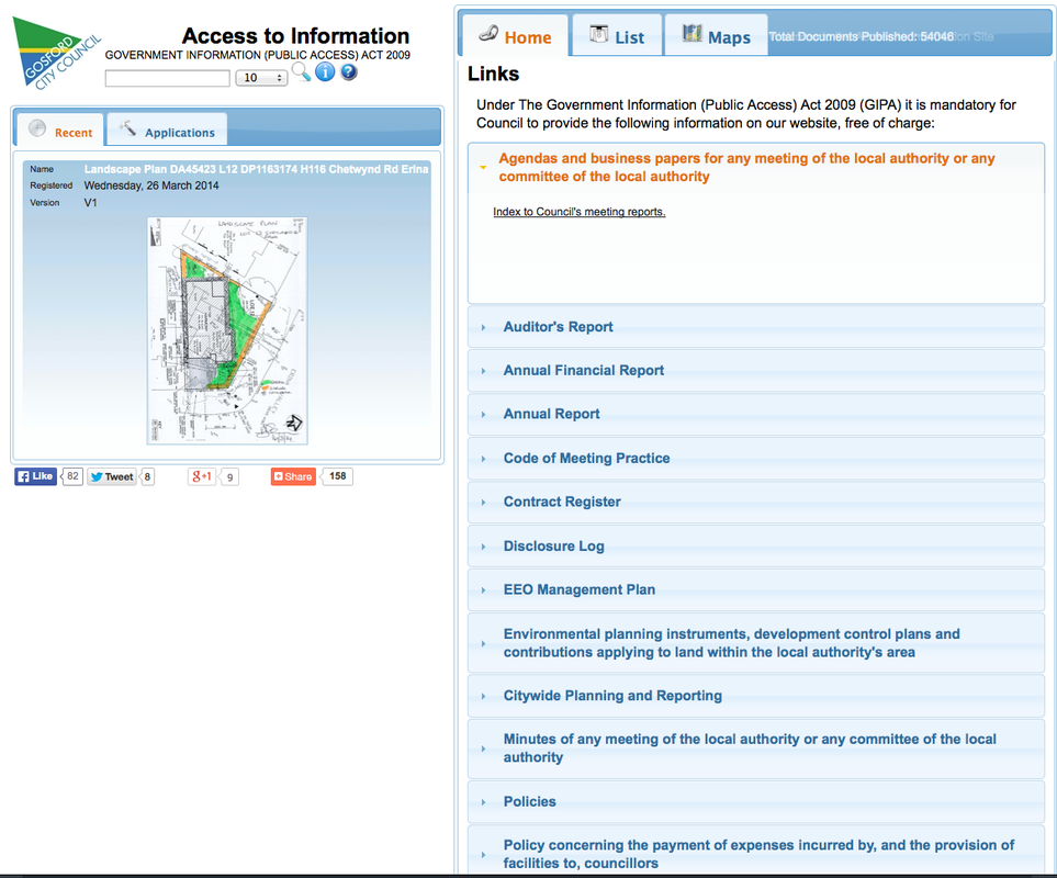
On the Gosford Council's Development Application Search page, you can browse for Development Applications (DA) in your area, look up the documents associated with a specific DA, access a range of other Council documents or get access to their mapping system.
The page has two halves. On the left is a window with two tabs:
On the right is a larger window with three tabs:
Browse for DAs by map
If you want to browse to see what’s happening in a particular area use the Maps tab on the section on the right:
Browse by street name or DA number
To find an address or a particular street, use the tab on the left hand side of the page:
On the Gosford Council's Development Application Search page, you can browse for Development Applications (DA) in your area, look up the documents associated with a specific DA, access a range of other Council documents or get access to their mapping system.
The page has two halves. On the left is a window with two tabs:
- Recent cycles automatically through images of recently submitted documents.
- Applications lets you search for DAs by street.
On the right is a larger window with three tabs:
- Home gives you more info about your current search.
- List gives you a menu with access to all kinds of Council Documents.
- Maps gives you two choices. The top option, Mapping Enquiry System (GEMS) gives you access to Council’s excellent mapping system. The bottom option Development Applications Pending Decision lets you search for current DAs via a map.
Browse for DAs by map
If you want to browse to see what’s happening in a particular area use the Maps tab on the section on the right:
- Choose Development Applications Pending Decision which will bring up a satellite map of the area.
- Click and drag the map with the mouse to bring our area in to view.
- Double click on the area of interest to zoom in. Current DAs are flagged with an orange pin.
- Click on the pin to bring up a description of the DA. In the text box that appears you can click on the Open Details link in the bottom right to see the documents associated with the DA or click on the cross in the top right corner to close the box.
Browse by street name or DA number
To find an address or a particular street, use the tab on the left hand side of the page:
- Select the Applications tab, and then By Location.
- Enter the suburb name (Hardy’s Bay, Killcare, Killcare Heights, Pretty Beach or Wagstaffe).
- Select the street name from the list provided. This will bring up the DAs in that street on the right hand side of the screen.