Soil Types
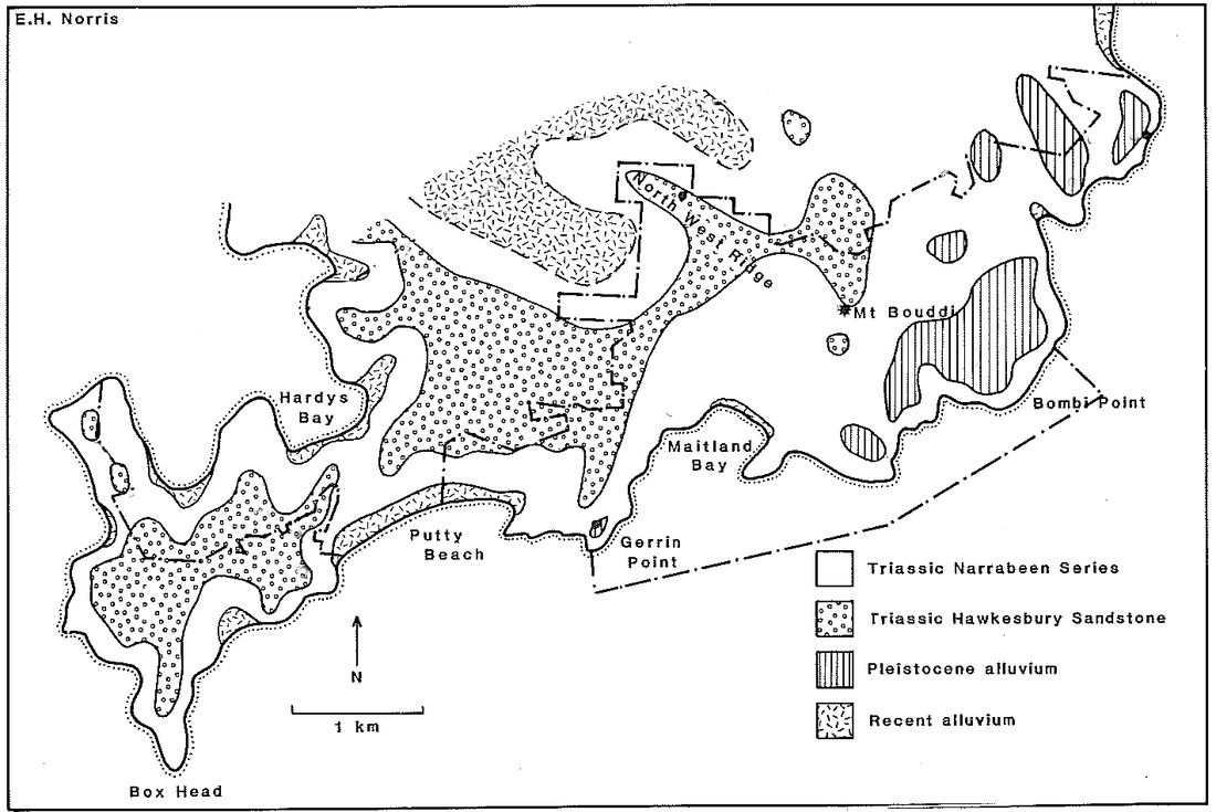
The four types of soil that are listed here form the basis of the description of the various plant communities. The Bouddi peninsula consists of two layers of sandstone both laid down in the Triassic period 250-200 million years ago and the more recent alluvial deposits on the foreshore of the bays and beaches:
1. Hawksbury sandstone. This is the upper and younger layer. It is generally a golden colour and has steep sides that form the escarpments in the area. It forms the higher parts of the peninsula: in the middle of Box Head (on either side of Hawkes Head Dr) and a band that includes Killcare Heights, the ridge extending out towards Daley’s Point and on either side of the Scenic Road in Bouddi NP. The stone is rich in quartz and is considered nutritionally poor. It was formed from the sediment from the erosion of mountains in an area of Gondwanaland that is now part of Antarctica.
2. The Narabeen group – represented in this area as the Terrigal formation. This is the lower and older of the two layers. It is formed from reddish sandstone (from its iron content) and is mixed with other sedimentary rocks such as shale and mudstone. It erodes more easily than does Hawksbury sandstone, which is why the rocks are more rounded and the slopes it forms more gentle. The soils of the Narabeen group are more nutritious than those of the Hawksbury sandstone. It is formed from the erosion of mountains located in what is now the centre of Australia - such as the Peterman Ranges.
3. Recent alluvial deposits. These are the sand that forms the beaches and dunes and the silt that has been laid down by the creeks that flow into Hardy’s Bay and Pretty beach
4. Older alluvial deposits that form the perched sandunes on Bombi moor.
You make the journey through these three layers whenever you drive up Wards Hill Rd to Killcare Heights, drop down from the Heights to the bay or the beach, walk from Wagstaffe to Box head or from Box Head down to Tallows, or down to Maitland Bay from the Scenic Rd.
Two maps of the soil types are from the Bouddi study and McRae's survey (shown below) of the Bouddi flora.
